

Morro do Preventório and Grassroots Mapping
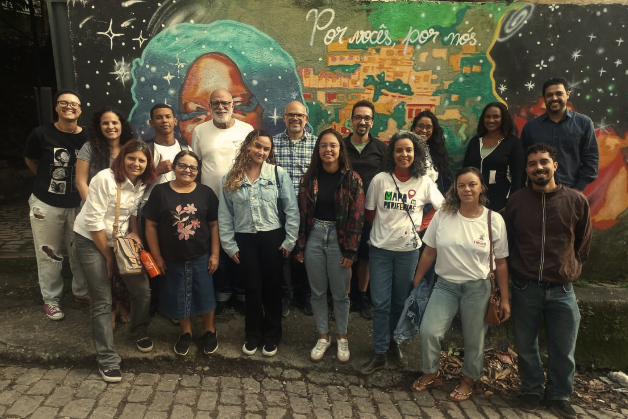
Held on July 6, the Grassroots Mapping Meeting on Data, Maps and Cartographies brought together 20 people at the Peripheral Research Station in Morro do Preventório, a favela in Charitas, Niterói, Rio de Janeiro’s sister city across Guanabara Bay in what is called the Leste Fluminense region, for a training workshop on grassroots mapping in favelas and its importance for climate adaptation.
According to the Marielle Franco Favela Dictionary, Morro do Preventório is Niterói’s largest favela, with an estimated population of over 5,000 residents:
“Its history dates back to the 19th century, when the imperial government built a large house, known as the ‘Preventório,’ to isolate patients with contagious diseases, such as tuberculosis, who arrived aboard ships docking in Rio de Janeiro. Over time, the surrounding area was occupied by workers and families, especially those from Brazil’s Northeast, giving rise to the community that exists today.”
Community mapping is a process by which the community itself documents its reality and identifies its strengths and vulnerabilities. This process fosters resident autonomy, deepens understanding of one’s own reality and promotes the sharing of local knowledge. It is a tool for social change, helping identify solutions to the challenges residents face while addressing the lack of data on favelas. By documenting real needs, residents themselves generate reliable data that enables public authorities to invest in ways that are truly useful and targeted.
Citizen-Generated Data for Climate Adaptation in Favelas
The July meeting was the first stage of the latest iteration of a long-term project in the community, whose previous version was part of the URBE Latam research project. The new project, called Participatory Research for Climate and Health Analysis in Favelas and Urban Communities (PACHA), also coordinated by Professor João Porto de Albuquerque, is a partnership between community organizations, Brazilian and UK universities, and local and national government bodies.
The project’s mapping work, a form of citizen-generated data (CGD), is designed to understand how climate change affects the health of favela residents; identify the factors that determine climate vulnerability; and develop participatory methods of data production capable of informing public policies on climate adaptation.
“We’ve identified the potential to generate data that feeds into programs already underway, like Vida Nova no Morro. We hope to do this in a way that makes [these programs’] investments as effective as possible, reducing [climate] impacts and meeting the needs of favelas.” — João Porto de Albuquerque
The training consists of building the capacity of the local team, conducting a manual survey of the area, identifying locations along with their strengths and vulnerabilities and, finally, entering the information into OpenStreetMap, a free collaborative digital map, and the Nós no Mapa app, developed in partnership with Mapa das Periferias, an initiative of the National Secretariat for the Peripheries.
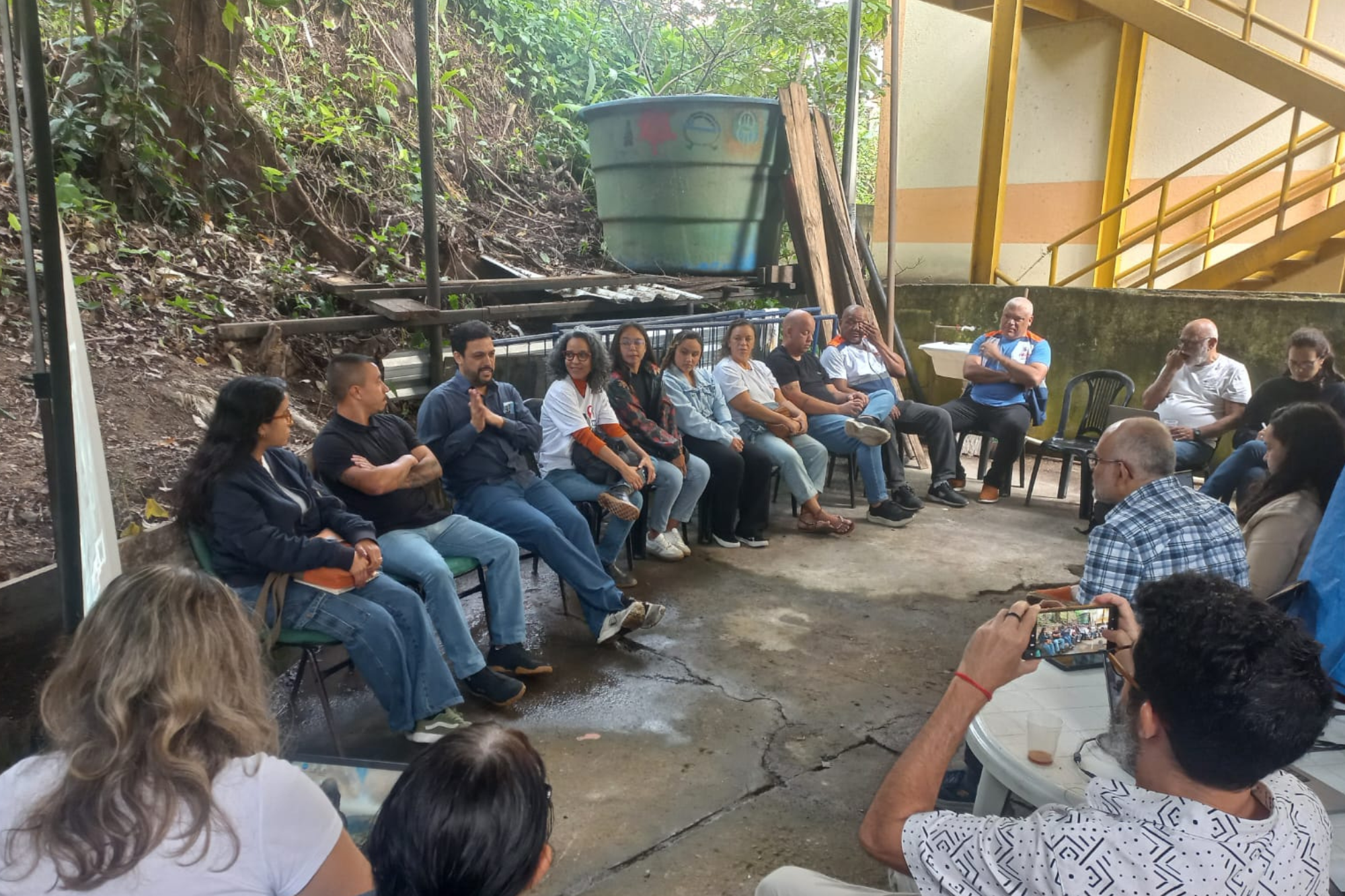
For Alessandra Figueiredo, born and raised in the neighboring municipality of São Gonçalo and a student who participated in URBE Latam’s previous mapping project in Morro do Preventório, the importance of this work also lies in its potential to change residents’ perspectives on the favela.
“These projects are important because they mean you don’t look at the place you live only through the lens of vulnerability. It’s not just [a place] with police operations or piles of trash. It’s also the place where I grew up, where I go to parties, the soccer court, the residents’ association, church… Focusing more on the good things has a really positive impact… This gives people a greater sense of belonging here.” — Alessandra Figueiredo
‘We Bring a Voice Because We’re the Ones Living Here’
Under the project’s timeline, the first favelas to be mapped will be Morro do Preventório and Jurujuba, both in Charitas, starting in August, with initial findings expected as early as October. Beyond Rio de Janeiro, the project is also being implemented in two other states: Rio Grande do Norte, in the city of Natal, and Paraná, in Curitiba, where pilot mapping has already been carried out in ten favelas. The project is expected to run for a total of three years, from mapping through data analysis.
Camila Leal, a consultant with the National Secretariat for the Peripheries, says the goal is for the mapping effort to be scaled up nationwide:
“This tool [Nós no Mapa] has been in development since 2024, with ten territories mapped across Brazil and over 1,000 points of strength and vulnerability identified by the communities themselves. The plan is to make the tool available for public use in October. Being part of Mapa das Periferias is precisely about creating a single national database with information to support public policies that are more in line with the realities of these places.”
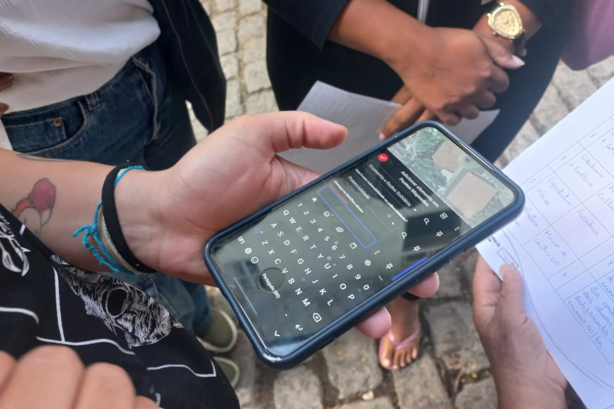
At the end of the meeting, participants got hands-on experience with the platforms by carrying out a quick mapping exercise in the community. For actress and Preventório native Ana Nery, the initiative amplifies residents’ voices:
“We bring a voice [information, data] because we’re the ones living here, [experiencing] the needs and the risks. In order to be able to grow [improve], we need to know what’s going on and show it to those who can help [the government].”
Fael Faustino, president of the Preventório Residents’ Association, hopes to pass this knowledge on throughout the region:
“This is the first time I’ve taken part [in something like this]. It’s an experience, something new for our community. The map can help identify a lot of high-risk spots and also [build up] our knowledge.”
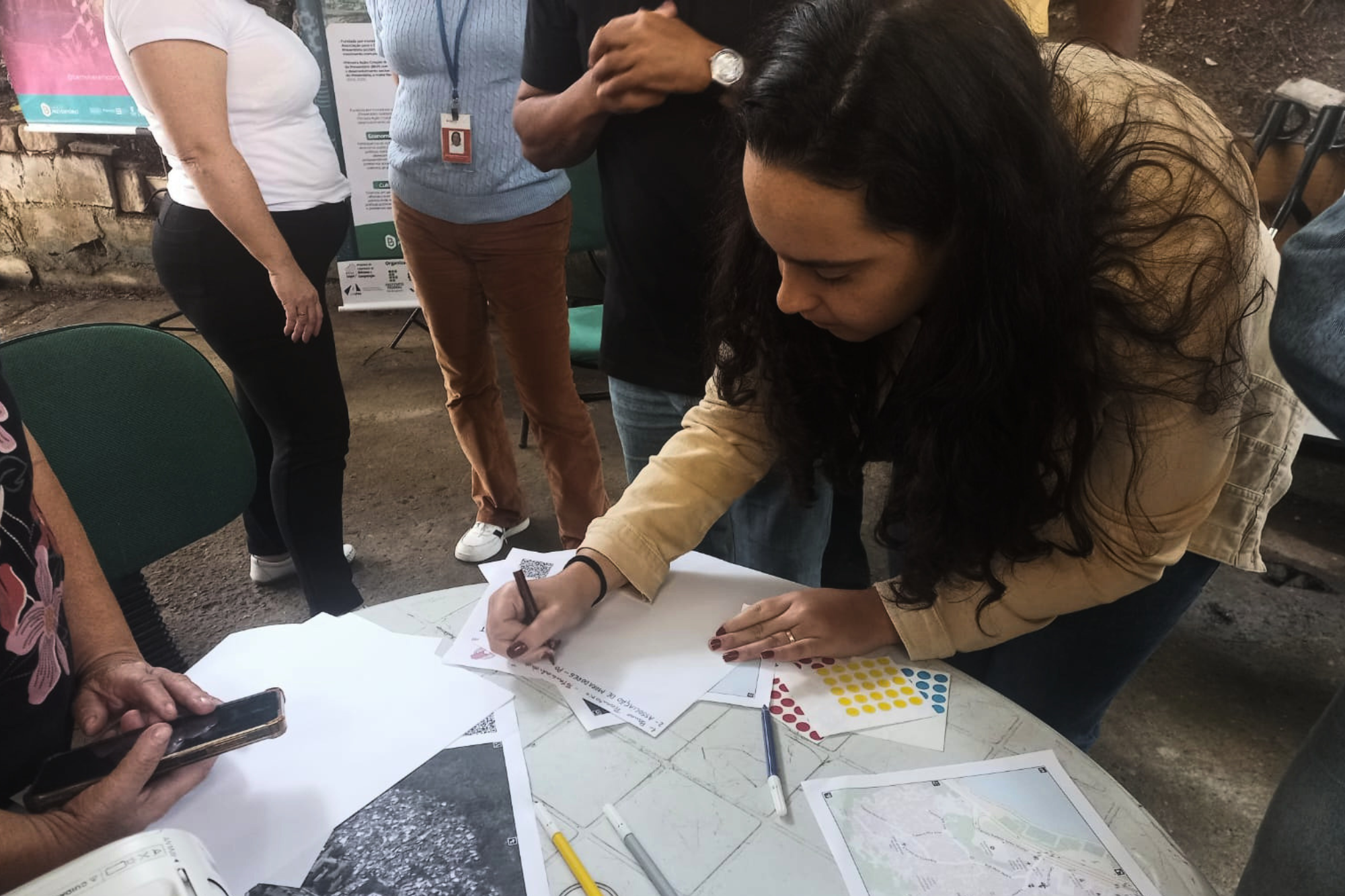
Those interested in the training can follow the project through the Mapa das Periferias portal and also access the Grassroots Mapping Guide, which provides step-by-step instructions for carrying out local mapping in their own communities.
Ver essa foto no Instagram
In attendance were the Morro do Preventório Residents’ Association and Preventório Bank, as well as residents of Morro do Preventório and neighboring communities such as Jurujuba, along with representatives from the Getúlio Vargas Foundation (FGV), the University of Glasgow, the Federal University of Rio de Janeiro (UFRJ), Petrobras, the Niterói City Government and the National Secretariat for the Peripheries.
About the author: Amanda Baroni Lopes is a journalism student at Unicarioca and was part of the first Journalism Laboratory organized by Maré’s community newspaper Maré de Notícias. She is the author of the Anti-Harassment Guide on Breaking, a handbook that explains what is and isn’t harassment to the Hip Hop audience and provides guidance on what to do in these situations. Lopes is from Morro do Timbau and currently lives in Vila do João, both favelas within the larger Maré favela complex.