 This article is part of a series created in partnership with the Behner Stiefel Center for Brazilian Studies at San Diego State University, to produce articles for the Digital Brazil Project on environmental justice in the favelas for RioOnWatch.
In recent years, climate change has intensified landslides in the city of Rio de Janeiro, with far reaching impacts on thousands of people, including residents in the favelas of Complexo do Lins and Complexo do 18 in Rio de Janeiro’s North Zone. Increased rainfall has saturated hillside soils, making them more susceptible to landslides.
Deforestation and asphalt-based urbanization exacerbate the impacts of heavy rains by creating impermeable surfaces, while the removal of vegetation reduces the ground’s ability to absorb water. Among other areas, the Tijuca Massif—one of Rio de Janeiro’s most important geological and ecological formations—is directly impacted. Home to some of the city’s most iconic landscapes, like Corcovado and Pedra da Gávea, the massif extends into the city’s outskirts. It serves as a biodiversity refuge, sheltering a rich variety of flora and fauna from the Atlantic Rainforest, and is part of Tijuca National Park, which offers a wide range of activities for nature and sports lovers.
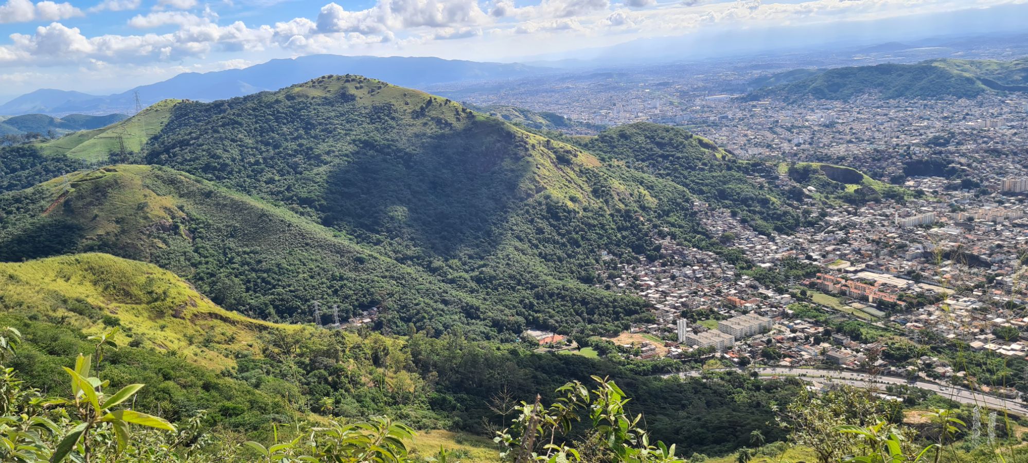
The Tijuca Massif is also home to the lesser-known Serra dos Pretos Forros Environmental Protection Area (APA), located between the Água Santa and Lins de Vasconcelos neighborhoods. It serves as a natural divide between Jacarepaguá and Grande Méier, in Rio’s West and North Zones, respectively. Created in 2000, the APA protects a region spanning 2,645.7 hectares. The name Serra dos Pretos Forros originated from the time when enslaved Black people sought refuge there, forming quilombos—territories of anti-slavery and anti-colonial resistance led by Black men and women. Later, this same area became home to favelas such as Complexo do Lins and Complexo do 18.
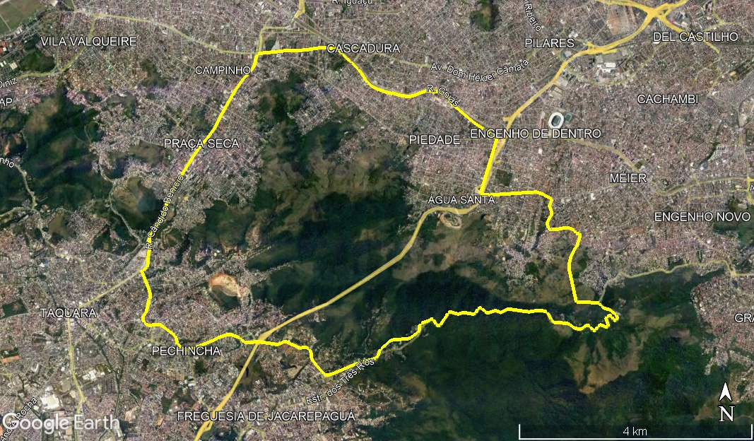
Complexo do Lins is made up of several favelas, including Outero, Camarista Méier, Ouro Preto, Pretos Forros, Morro do Céu, Morro Nossa Senhora da Guia, Santa Terezinha, Morro da Cachoeira Grande, Morro da Cotia, Cachoeirinha, Dona Francisca, Morro do Amor, Barro Preto, Vila Cabuçu, Barro Vermelho, Morro da Bacia, and Morro do Encontro.
Complexo do 18 is made up of Morro do 18, Morro do Gambá, Morro do Encontro, Lemos de Brito, and Saçu. The populations of both complexes have been heavily impacted by extreme rains and landslides in recent years.
Far From Ideal: Neighboring Communities, Different Realities
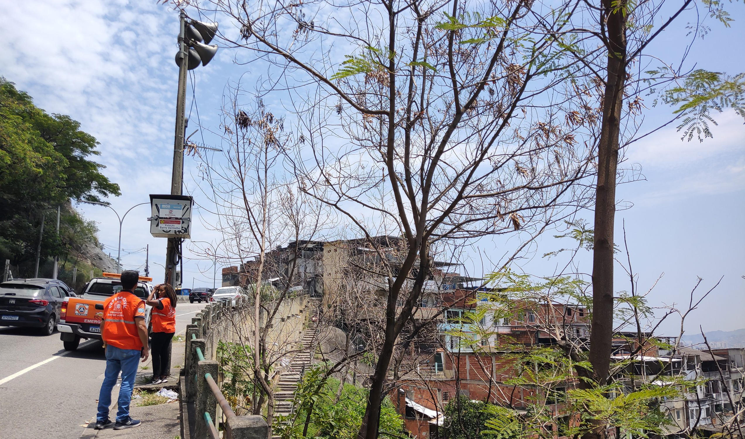
Despite being located within the same APA and neighboring each other, the reality for one complex is vastly different from the other when it comes to public interventions for mitigating climate emergencies. While Complexo do Lins benefits from sirens, shelter points, slope containment works on the Grajaú-Jacarepaguá Road, and emergency training for residents, none of these measures exist in Complexo do 18.
A teacher, resident of Complexo do 18, and president of the 18 Family Social Project, Lucas Prates explains that in addition to the absence of sirens, no preventative training or drills have ever been conducted for residents, despite numerous requests from the community.
“The community has a history of houses being vacated by the Civil Defense due to landslides. In the last five years, four major landslides have occurred, resulting in falling barriers and access to four houses being either totally or partially prohibited.” — Lucas Prates
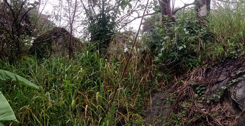
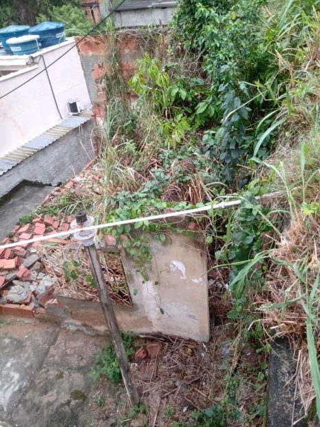
According to Prates, the unimaginable happened: the ravine gave way, carrying with it rocks and the walls of an old house that had been previously demolished by the Civil Defense. The debris struck another house, destroying it in the process.
Raised in Cachoeira Grande—one of the favelas in Complexo do Lins—the social worker Rafael Sousa says that most favelas in the Complex have sirens. Sousa, who is also the founder of the community news page Voz do Lins, explains that some of these sirens needed maintenance, but have since been repaired. According to him, over the past six years, there has only been one evacuation drill to the support centers in the favela.
“Generally speaking, several landslides have occurred, both with rocks that have blocked off large areas and debris from ravines that actually buried people in the past, though without fatal victims. As for the number of homes impacted, I cannot provide an exact figure. Over the last 30 years, many houses have been affected, and sometimes a landslide might block a path or close a road. Houses are not always directly impacted, but in many cases, they have been.” — Rafael Sousa
In May 2023, a landslide occurred in Morro da Cotia, Complexo do Lins, leaving eight people injured and one dead. Of those injured, seven were minors, including four young children. All belonged to the same family, whose house was completely destroyed, while two other houses were condemned. According to the Casa Fluminense Climate Dashboard, Complexo do Lins and Complexo do 18 together have a total of 328 homes in landslide risk areas.
The Flood and Landslide High Risk Map, produced by Casa Fluminense, indicates that Complexo do 18 has 81 houses located in landslide risk areas, over half of which are in the Lemos de Brito favela, in Quintino Bocaiúva, where 42 homes are in risk zones. Overall, the map shows that 70% of people impacted by extreme climate events, such as heavy rains and landslides, reside in high-risk areas. It also reveals that 60% of those hospitalized for waterborne diseases are Black, highlighting the intersection of environmental racism and climate injustice.
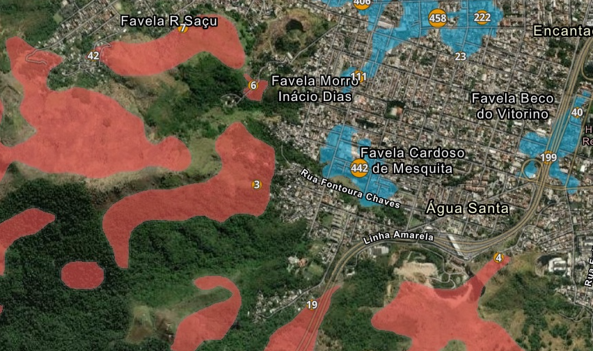
In Complexo do Lins, there are 411 houses in landslide risk areas, 247 of which are in the favelas Dona Franciscana, Barro Preto, and Cabuçu, in Lins de Vasconcelos. Combined, both complexes have 492 houses located in landslide risk areas.
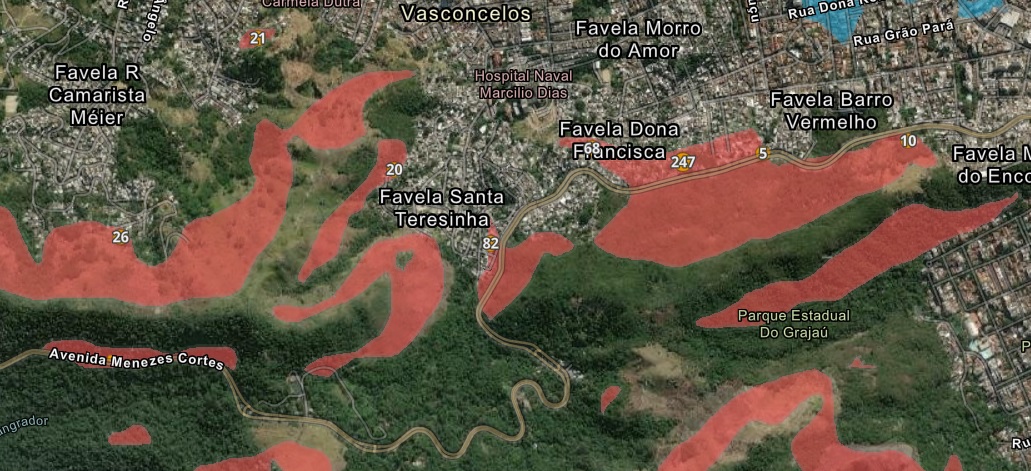
The map used the addresses registered by the 2022 Census, conducted by the Brazilian Institute of Geography and Statistics (IBGE), in Rio de Janeiro’s metropolitan region, and their relationship with the susceptibility to gravitational mass movements and flooding, made available on a municipal scale by the Brazilian Geological Service (SGB).
It is estimated that the damage caused by landslides and flooding in the Rio de Janeiro Metropolitan Region over the last five years amounts to over R$500 million (~US$81 million). The dashboard also shows that one in five households in Rio are located in high flood risk areas, one in 100 households are in high landslide risk areas, and 3 million people are affected by extreme rain events.
Sousa reported that a landslide occurred about two years ago, but it was not naturally caused. It was due to water seepage in a geotechnically risky area in Morro da Cotia and resulted in one fatality.
“The residents’ situation really depends on the community. Some areas are much more susceptible to landslides, such as Boca do Mato, Morro do Céu, Morro da Cotia, Encontro, Cachoeira Grande, part of Cachoeirinha, Barro Preto, and Vila Cabuçu. These areas are steeper and have many watercourses, which increases the risk of such events. In these communities, people are more concerned about the possibility of landslides.” — Rafael Sousa
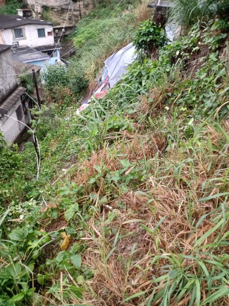
Prates said that three families were forced out of their homes and lost most of their furnishings. He highlighted that incidents of falling trees are common and often completely or partially destroy houses. Some people seek shelter with relatives during periods of heavy rain, lightning, and strong winds, which contribute to climate anxiety.
“The most recent one happened this summer. A large landslide on Rua Laís Areda put several houses in the favela at risk, and during the same period, another large landslide in the forest region disrupted the community’s water supply for days.” — Lucas Prates
Prates described how the ravine at the base of a house collapsed, hit the house below, and blocked the path for months. He pointed out that the white house below has a mark on the wall indicating how high the mud reached during the last landslide.
No Sirens Installed During the Current Municipal Administration (2021-2024)
When questioned through the Freedom of Information Act, Rio’s City Hall reported that the Sound Alarm System consists of 164 fully operational sound stations. In its response, City Hall stated that no requests for new siren installations had been received, and no new installations had been carried out during the current municipal administration, only maintenance work on existing sirens and training sessions.
“The installation of Sound Alarm System stations began in 2011, following the heavy rains of April 2010, and was fully completed in 2012. The first station was inaugurated on January 21, 2011, in Morro do Borel, Tijuca, with three speaker systems directed toward high-risk areas.” — Rio de Janeiro City Hall
City Hall explained that the maintenance contract for the Sound Alarm System also includes preventative services, with scheduled technical visits to the stations and corrective repairs when operational faults are identified. The company responsible for this work is Gridlab System and Services Ltda., with a total contract value of R$7,899,000.13 (approximately $1,278,155.36 USD) and an initial contractual term of 720 days.
“All stations of the Sound Alarm System undergo preventative maintenance every 30 days. Corrective repairs are carried out whenever operational faults are identified at any station.” — Rio de Janeiro City Hall
City Hall also reported that studies are underway to update the city’s geological risk map. Once the studies are concluded, it will be possible to mitigate high-risk areas in some communities, which could lead to the identification of the need for new sirens in additional areas. However, no timeline for the conclusion of these studies was provided.
Regarding the installation of new sirens, City Hall also reported that studies are underway to update the city’s geological risk map. Once the studies are concluded, it will be possible to mitigate high-risk areas in some communities, which could lead to the identification of the need for new sirens in additional areas. However, no timeline for the conclusion of these studies was provided.
No Sirens, No Training, No Evacuation Exercises in Complexo do 18
Lucas Prates stated that despite himself and other local leaders requesting, through various channels, sirens and training for Complexo do 18, nothing has been done so far. Without sirens, drills, or training, the population is left to face climate emergencies on their own.
“We have already reached out to the Civil Defense for sirens to be installed and a plan of action for strong rains to be created. Many emails were sent, with no response. On the occasions when the Civil Defense came here at the request of residents, we once again asked for this alert and support infrastructure. And still, nothing.” — Lucas Prates
Training and drills have never been conducted in Complexo do 18. In contrast, they have taken place in Complexo do Lins, with the most recent exercise occurring in September 2023.
In a response obtained via the Freedom of Information Act, Rio’s City Hall clarified that training in civil defense, first aid, fire prevention, and firefighting is conducted as part of setting up Civil Defense and Protection Centers (NUPDEC). Additionally, Evacuation Drills are carried out. Setting up NUPDECs and conducting drills are duties of the municipality’s Civil Defense and Protection Subsecretariat.
“The Evacuation Drills in areas of high geological risk are part of the set of strategies implemented by the Civil Defense and Protection Subsecretariat to prevent and prepare for the critical periods associated with heavy rains.” — Rio de Janeiro City Hall
According to City Hall, when evacuation drills are conducted in areas of high geological risk, they adhere to the following timetable:
| Time | Activity |
| 9:00 | Activities begin with the mobilization of the community network composed of volunteers, residents, and municipal bodies. The Civil Defense opens the event and presents the strategy to the participants. The Support Centers are opened and prepared to accommodate residents from high-risk areas. |
| 9:30 | Teams are positioned at the Support Centers / Meeting Points, prepared to receive residents. The Disaster Monitoring and Alerts Management team from SUBPDEC, operating out of Rio’s Control Center, activates the sirens with a sound alert informing residents of the possibility of heavy rain in the coming hours. |
| 10:00 | The sirens are activated through Rio’s Control Center to issue the evacuation warning, notifying residents of the need to move to the Support Centers or other safe locations. The community network assists residents during the evacuation process and welcomes them, using the opportunity to present the strategy, provide information on emergency services (Fire Department 193, Civil Defense 199), address questions, and respond to service requests. |
| 11:00 | The final siren is sounded with a message signaling a return to normality. At this point, residents are informed that conditions have improved, allowing them to safely return to their homes. |
City Hall also reported that from January to August 2024, “one Civil Defense and Protection Center was established, and 15 Evacuation Drills were conducted,” none of which took place in Complexo do Lins or Complexo do 18. Under the current municipal administration (2021–2024), 17 evacuation drills were carried out in risk areas, 14 of which addressed geological risks and 3 targeted flooding risks. City Hall further stated that 24 neighborhoods and communities have already received some form of activity or support.
Under the current municipal administration (2021–2024), 14 geological risk preparation exercises were carried out. In Complexo do Lins, these took place on July 4, 2021, September 1, 2023, and May 17, 2024. Of the 15 favelas that make up Complexo do Lins, only five received preparation exercises: Morro do Céu and Pretos Forros (twice each), and Matriz, Ouro Preto, and São João (once each). No activities were conducted in the favelas of Complexo do 18. In total, City Hall estimates that 456 people participated in at least one of the 17 training sessions held by NUPDEC.
Sousa says there is constant dialogue between the Civil Defense and the Residents’ Association, and that Voz do Lins maintains direct contact with the North Zone’s Civil Defense manager, regularly sharing information.
“There is a group that advises the residents’ associations in Complexo do Lins, keeping an open line of communication with the Civil Defense, especially during periods of heavy rain. We support communication and dialogue. We also have direct contact with the North Zone’s Civil Defense manager to address these concerns. Together with community leaders, we identify problems and share this information.” — Rafael Sousa
18 Family Social Project and Voz do Lins Join Forces to Reduce Environmental Impacts
Mitigating landslides involves a combination of preventative measures, continuous monitoring, and emergency actions. Reforestation should also be embedded in public policy to maintain vegetation with deep root systems on hills, anchoring the soil even when drenched.
Implementing drainage systems is an important way to direct rainwater away from the hillsides and avoid oversaturation of the soil. Projects such as educational campaigns to inform the population about risks and preventative measures are key to raising awareness and educating residents. The 18 Family Social Project and Voz do Lins work on initiatives to reduce environmental impacts in their communities.
Lucas Prates says there are four projects currently active in the favelas of Complexo do 18: Reforestation Collective Action, Hiking through the 18, Pretos Forros Collective, and 18 Family Social Project, all aiming to raise awareness and restore vegetation in deforested areas of the Pretos Forros APA.
Rafael Sousa explains that Voz do Lins, founded in 2013, participates in the development of the Grande Méier 2030 Agenda and collaborated with the Oswaldo Cruz Foundation (Fiocruz) on a research project addressing environmental, sanitation, and health issues in their community.
“It’s more of a territorial study than a research project, addressing issues related to the environment, basic sanitation, and health. It’s like taking an X-ray, so we can examine how the environment is affecting people’s lives, climate change, and the scarcity of treated water. Based on this plan, we will install filters to provide access to treated and drinking water. We will also implement evapotranspiration basins to prevent sewage from being discharged into the rivers.” — Rafael Sousa

How Does the Alert System Work: What to Do During Extreme Rain and Landslides?
When questioned via the Freedom of Information Act, City Hall explained that the Community Alarm and Alert System for Heavy Rain monitors 103 favelas with high geological risk, which is actioned when rain levels reach a defined limit set for preventative evacuation.
“The Alarm System is based on monitoring critical rain indicators set by meteorologists at Alerta Rio, situated in COR [Rio’s Control Center], where Municipal Civil Defense workers work in an integrated way, 24 hours a day in the Disaster Monitoring and Alert Management Department. Community leaders and volunteers from favelas support this work alongside predetermined support centers in case evacuations are necessary. The system integrates 83 rain gauges, 164 sirens, and 194 support centers.” — Rio de Janeiro City Hall
The Alerta Rio system is a crucial tool for warning residents about heavy rains and landslide risks. For this reason, it is essential to stay alert, monitor meteorological warnings, and pay attention to emergency sirens. Above all, the siren system must be expanded to all areas in Rio that are vulnerable to landslides. Once the system is installed, residents must be trained, as hearing a siren in the middle of a climate emergency and wanting to evacuate an area under threat is not enough. People need to know evacuation routes, nearby temporary shelters, and what actions to take—or avoid. For this to be effective, City Hall and the State Government must offer training sessions and drills for favela populations.
Here’s what to do before, during, and after a landslide:
- Before the Landslide
-
- Stay Alert to Warnings: Monitor meteorological alerts and emergency sirens. The Alerta Rio system is a vital resource for predicting heavy rains and landslide risks.
- Plan Your Escape Routes: Get familiar with the nearest evacuation routes and temporary shelters.
-
- During the Landslide
-
- Evacuate Immediately: If you hear the sirens or notice signs of a landslide—such as cracks in the soil or rumbling noises—leave the area without delay.
- Avoid Risk Areas: Do not attempt to cross areas where a landslide is in progress. Seek a safe location, away from slopes and valleys.
- Help Your Neighbors: If possible, assist elderly individuals, children, and those with mobility challenges in evacuating.
-
- After the Landslide
-
- Avoid Returning Immediately: Do not go back to the affected area until authorities confirm it is safe.
- Inform the Authorities: If you are safe, notify authorities about the landslide and any individuals who might be in danger.
- Seek Shelter: Go to a temporary shelter if your home has been damaged or if authorities recommend it.
-
- Additional Safety Measures
-
- Keep an Emergency Kit: Maintain a kit with essential supplies, such as water, non-perishable food, medications, flashlights, and batteries.
- Educate Yourself and Participate in Training Sessions: Join training programs and awareness campaigns to learn how to respond during natural disasters.
-
Remember to always keep the following numbers handy: State Civil Defense (199), Municipal Civil Defense (1746), Fire Department (193), and Military Police (190). Also, make sure to access additional information on the websites of civil defense institutions and the Center for Weather Forecast and Climatic Studies (Cepen).
About the author: Felipe Migliani has a degree in journalism from Unicarioca with a focus on investigative journalism. Working as an independent freelance reporter at Meia Hora and Estadão newspapers, he also collaborates with the Coletivo Engenhos de Histórias, which investigates and recovers history and memories from the Grande Méier region, and with PerifaConnection.
